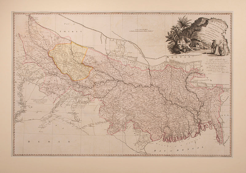
A Map of Bengal, Bahar, Oude & Allahabad
with Part of Agra and Delhi Exhibiting the Course of the Ganges from the Hurdwar to the Sea.
London, Pritned for W[illia]m Faden, Geog[rapher] to the King, 1786
Major James Rennell, FRS, FRSE, FRGS (1742-1830) was an East India Company officer, geographer, and pioneer of oceanography. As Surveyor General of Bengal, he produced the first accurate maps of the region and outlines of the Indian subcontinent. Rennell had earlier been tasked with surveying the river Ganges to find the shortest perennially navigable route to the Hooghly River and Calcutta avoirding hte Murshidabad shallows.
Dedicated 'To John Stables Esq. One of the Supreme Council of Bengal This Map, Engraved from the Original Drawing on the same Scale in the Possession of the Hon[ora]ble East India Company (communicated to him by the late Mr Dury) is respectfully Inscribed by His obliged and Obedient Servant Will[ia]m Faden'.
Large engraved map on two conjoined sheets, with original hand-colouring; scale approx. 1:1,827,000 (miles); size: 71.5 cm by 106.5 cm, sheet size: 76.5 cm by 115 cm.
Mounted: 90.5 cm by 124 cm.
BMC Cartographic Items Maps K.Top.115.29.2 TAB.
Provenance
Delivery
We offer secure and express delivery on all local and international orders of rare books, maps and prints placed through this website.


